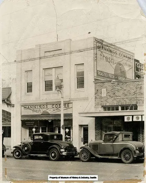
In 1957, someone proposed building a shopping center on the southwest edge of Tacoma. Downtown merchants fought it. For four years, plans stalled, names changed, and the project sat. By 1961 it had a name — Tacoma Mall — and the city council approved it in December of that year. Nobody talked much about what was underneath the site.
Ground was broken on June 19, 1963. The mall that opened on October 13, 1965 was the first fully enclosed shopping center in the Pacific Northwest. At $40 million it was the largest retail investment Pierce County had ever seen. The Bon Marché was the anchor. JCPenney followed. A Dixieland jazz band played at the grand opening. Tacoma's L. Everett Landon gave a speech. A ceremonial ribbon was cut.
It was, by every measure of its era, a triumph.
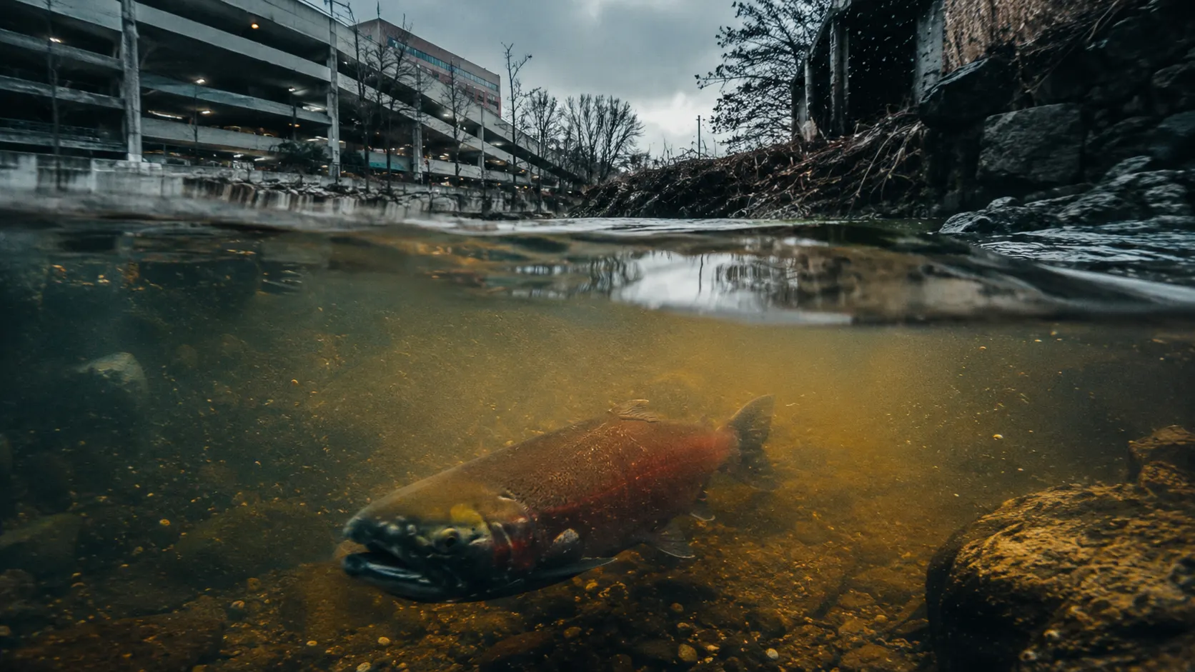
What the planning documents did not feature in the grand opening coverage was this: the Tacoma Mall sits within two sensitive stormwater basins. Flett Creek — an EPA target watershed — runs beneath and around the mall footprint. Flett Creek connects to Chambers Creek, a salmon-bearing stream. Chambers Creek connects to the Thea Foss Waterway.
The Thea Foss Waterway is a Superfund site. Its remediation has cost $105 million dollars. That money came from public sources, from state environmental funds, from the people who lived downstream and had no seat at the table in December 1961 when the Tacoma City Council voted yes.
This is not ancient history. The City of Tacoma's own planning documents acknowledge it plainly. The Tacoma Mall Center Subarea Plan, in describing the area designated as a Regional Growth Center, notes that the site is located within two sensitive stormwater basins including Flett Creek, an EPA target watershed which influences Chambers Creek, a salmon-bearing stream, and the Thea Foss Waterway, a Superfund site remediated at a cost of $105 million dollars.
The designation — Regional Growth Center — remains active today.
The Puget Sound Regional Council assigned it. The City of Tacoma accepted it. The planning documents that once called the original mall development smart growth now call the same footprint a focal point for future jobs and housing concentration.
---
Sixty years have passed since the ribbon was cut.
The mall has been through its own cycles — expansion in the 1970s, Sears in 1981, anchor departures, a shooting in 2005, the demolition of the Sears wing in 2019. Simon Property Group, the world's largest mall owner, now operates it. A lifestyle village addition is under construction at the rear of the complex. The mall still draws millions of visitors annually, though the number has been declining for years along with mall traffic nationwide.
And downtown Tacoma — the district that lost its anchor retailers to the mall in the 1960s, that tried to compensate with parking garages and a pedestrian mall on Broadway that failed and was eventually reopened to traffic — is still finding its footing.
The $105 million was paid. The salmon stream is still compromised. The watershed is still sensitive. The designation is unchanged. And the plan for what comes next calls for 59,000 new homes in the Tacoma region by 2050, with the Mall Center identified as one of the primary sites for that density.
The infrastructure beneath it was built for cars. The watershed above it was built by glaciers. Neither was consulted in December 1961, or in the planning documents that followed, or in the growth center designation that persists today.
---
Who decided this?
The answer is specific. The Southcenter Corporation, a division of Allied Stores of New York. The Tacoma City Council of December 1961. The planners who designated a Superfund-adjacent watershed as a Regional Growth Center. The subsequent councils that have maintained that designation across six decades.
Who is deciding now?
That answer is less specific. It involves the Puget Sound Regional Council, the City of Tacoma's Planning and Development Services department, Pierce County, and a state growth management framework that identifies this site as appropriate for density without fully resolving the infrastructure and environmental questions that the original development created and left for later generations to pay for.
What would Tacoma build if it started over?
That is the question The Grey Revolution's Then & Now series is designed to ask. Not to answer — the answer belongs to the people of Tacoma. But to ask it clearly, with the history visible, with the cost on the table, with the salmon stream in the frame.
Every beam. Every rail. Every cup of coffee brewed on South Tacoma Way carries the echo of decisions made in rooms where the creek had no voice.
This is The Loom — Tacoma. Pull the thread. Follow the story.
---
**Sources and references:**
City of Tacoma Regional Growth Centers — tacoma.gov
Tacoma Mall Subarea Plan and EIS — City of Tacoma Planning Documents 2014
Tacoma Mall history — Mall Hall of Fame / Mallmanac.com
Downtown Tacoma history — Wikipedia / Tacoma Public Library
Commencement Bay Superfund — US EPA